


Before any development, construction, or land use change takes place, understanding the cultural heritage significance of an area is essential. A Desk-Based Cultural Heritage Assessment (DBA) is a systematic review and analysis of existing information relating to the archaeological, historical, and cultural heritage of a study area. It forms the foundation of any heritage impact evaluation, providing developers, planners, and heritage authorities with the knowledge needed to make informed decisions that respect and protect our shared cultural heritage.
A Desk-Based Assessment is a professional study that collates, reviews, and interprets all available existing information about the heritage of a specific area without the need for physical fieldwork. It draws on a wide range of data sources including national and local heritage registers, archaeological site records, historical maps, aerial photographs, geological surveys, previous archaeological reports, architectural records, and published academic literature. The assessment evaluates the nature, extent, and significance of known and potential heritage assets within and surrounding the study area, providing a clear picture of what may be at risk from proposed development activities.
The quality of a desk-based assessment depends on the breadth and depth of information gathered. Our research draws from multiple sources including national monument records, sites and monuments registers, historic environment records (HER), planning authority databases, national archives, museum collections, estate maps, Ordnance Survey maps from various periods, LiDAR datasets, aerial photograph libraries, and satellite imagery. We also consult grey literature reports from previous archaeological investigations, environmental impact assessments, and planning applications in the vicinity. This multi-source approach ensures that all known and potential heritage assets are captured and evaluated comprehensively.
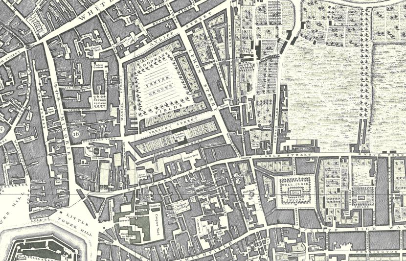
Historical maps and cartographic records provide invaluable evidence of past land use, settlement patterns, field systems, transport routes, and landscape evolution. We conduct detailed analysis of historical mapping from different periods to track landscape change over time and identify features that may no longer be visible on the ground but could survive as buried archaeological remains. Aerial photograph interpretation, including analysis of cropmarks, soilmarks, and shadow marks, further enhances our understanding of buried features and contributes to a more complete assessment of heritage potential across the study area.
A core component of the desk-based assessment is the evaluation of heritage significance. Each identified heritage asset is assessed against established criteria including archaeological, historical, architectural, artistic, scientific, social, and communal values. Significance is graded in accordance with national and international heritage assessment frameworks, taking into account the asset's rarity, representativeness, integrity, condition, and potential to contribute new knowledge. This significance evaluation forms the basis for determining the level of impact that proposed development activities may have on heritage assets and informing appropriate mitigation strategies.
In addition to documenting known heritage assets, a desk-based assessment evaluates the potential for previously unrecorded archaeological remains to exist within the study area. This is achieved by analyzing the geological and topographical context, proximity to known sites, historical land use patterns, soil conditions, and the intensity of past disturbance. Areas of high, moderate, or low archaeological potential are mapped and described, providing a spatial understanding of where buried heritage assets may be concentrated. This information guides the scope and design of any subsequent fieldwork programs such as geophysical surveys, trial trenching, or watching briefs.
Desk-based assessments are frequently required as part of the planning and environmental impact assessment process. Our reports are prepared in accordance with national heritage legislation, planning policy guidelines, and professional standards set by recognized archaeological and heritage bodies. We liaise with heritage authorities, planning departments, and statutory consultees to ensure that our assessments meet all regulatory requirements. Our reports provide developers and project teams with clear, evidence-based recommendations on heritage impact mitigation, further investigation requirements, and conditions that may be attached to planning permissions.
Our desk-based cultural heritage assessments support a wide range of project types and sectors including residential and commercial development, road and rail infrastructure, renewable energy projects, pipeline and utility corridors, mining and quarrying operations, and land management programs. Whether for small-scale planning applications or large linear infrastructure projects, our assessments provide the heritage baseline that developers, environmental consultants, and planning authorities need to ensure that cultural heritage is appropriately considered, protected, and where necessary, recorded before any ground disturbance takes place.