
Consider employing 3D laser scanning technology when planning your next construction project if you want to reduce labor costs, increase material cost estimates, and save time. The newest BIM technique, laser scanning, provides a precise, economical, and highly integrated way to virtually model construction, retrofitting, and restoration projects. This article delves deeper into laser scanning technology, how it may be used in building projects, and the costs and advantages of this cutting-edge new technique.
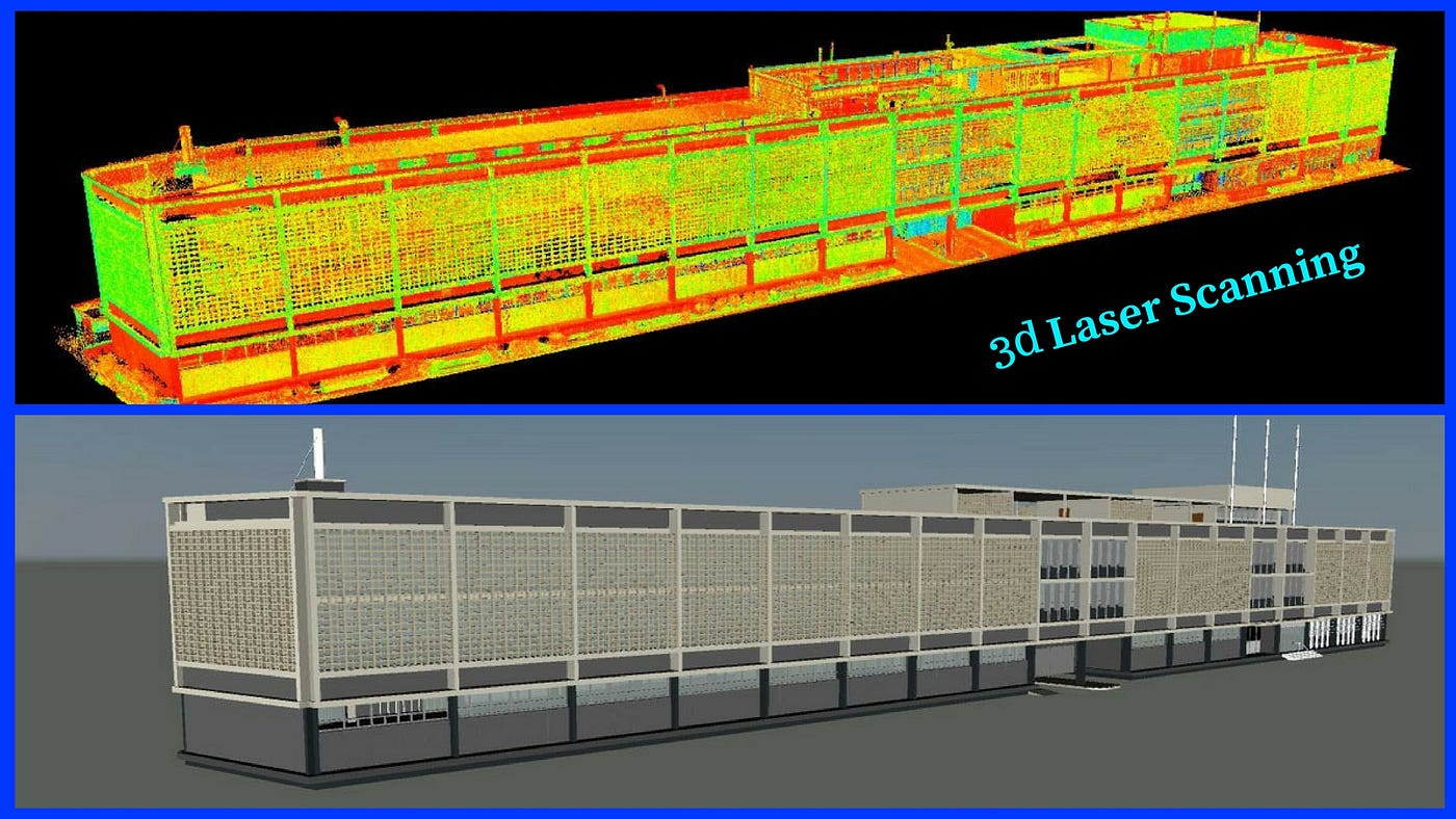
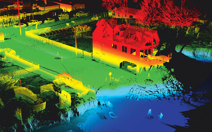
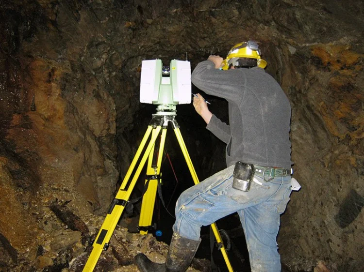
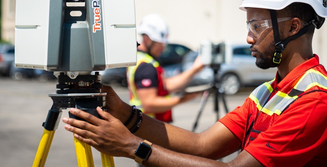
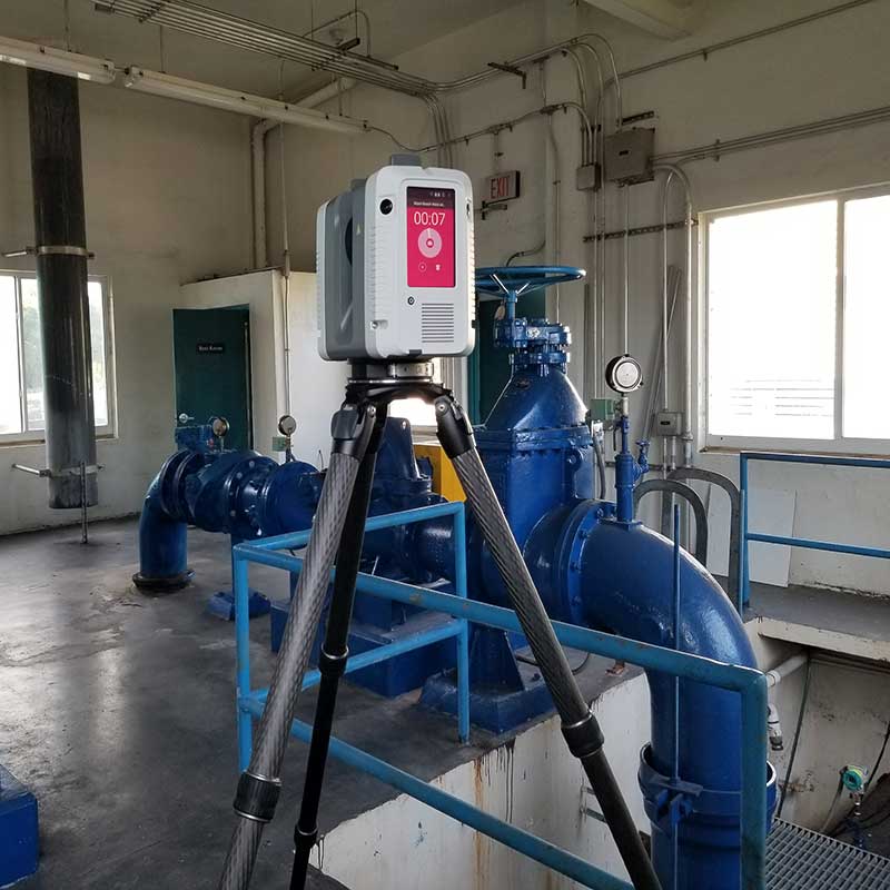
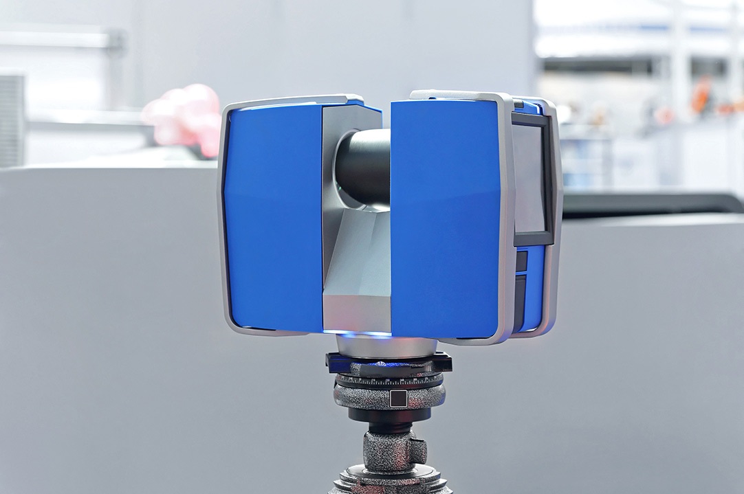
Contextualizing 3D Laser Scanning The most precise technique for building information modelling is laser scanning. A point cloud survey, often known as LIDAR (a combination of the words "light" and "radar"), is a method in which a laser scanner quickly and accurately measures the distance between densely scanned points over an item. Companies employ a tripod-mounted high-speed laser with an integrated camera. Each time a light ray strikes a surface in the surroundings, the system generates a data point that represents the distance between the laser scanner and that surface. The laser releases light beams at a very rapid pace. Laser scanners can scan approximately a million different spots per second at a radius of up to 300 meters. For every 100 meters between the scanner and the target surface, the normal error range for a laser scanner is plus or minus two millimeters, resulting in readings that are not only quick but also incredibly accurate.
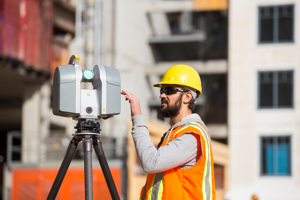
Practical Methods and Integration for 3D Laser Scanning Any significant construction project should include 3D laser scanning in its budget, and the top companies are constantly developing cutting-edge solutions to achieve the greatest outcomes at the lowest possible price. Companies are mounting laser scanners onto helicopters and drones in addition to the standard laser, camera, and tripod setup to create an even more precise 3D mapping of massive structures. Up till recently, the construction sectors of renovation and restoration have seen the most success using 3D laser scanning. Laser scanning is one of the best ways to map the area and figure out how to best complete the necessary work without disturbing or harming any other part of the building structure when the job site is a National Heritage Building and you need to upgrade the HVAC and fire protection infrastructure.

In order to plan building projects, engineers and architects employ other software that combines perfectly with laser scanning technologies. All of the major makers of CAD, modelling, and BIM software have created compatibility add-ons that enable the uploading of point cloud data produced by laser scanners into the system, creating 3D images that are excellent for project planning or enabling architects to design building upgrades on top of an image of the existing structure. Laser scanning users exhibit a retention rate of approximately 100%, indicating that they are unlikely ever to return to conventional survey techniques for their BIM or CAD requirements. However, laser companies aren't just interested in the building industry; they're also employing laser technology to assist police enforcement in developing all-terrain exploratory robots that use thermal imaging to find hazards in their surroundings. survey methods for their BIM or CAD needs.
By comparing the anticipated end state to a point cloud map of the present development, laser scanners and 3D printing could be utilized to quickly produce and replace building components or as a way to assess progress on a specific construction project.
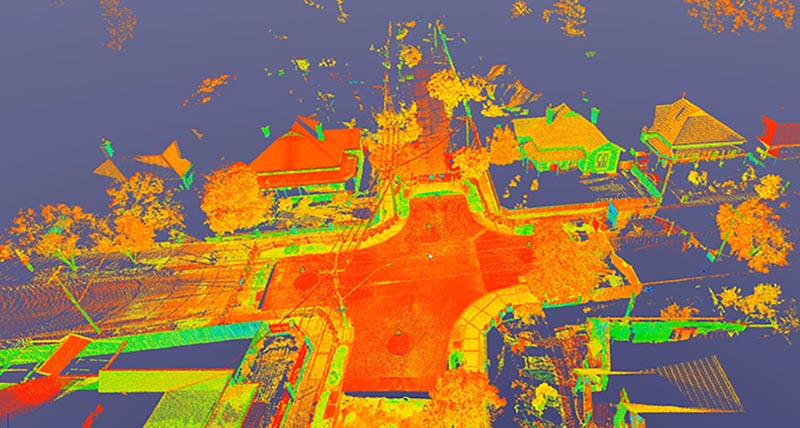
How can we precisely map our work sites to optimize productivity, planning, and coordination? This is a very basic and evident problem that construction firms encounter every day. Laser scanning technology provides a solution. Previously, surveyors might provide the general layout, and architects were left to produce scale drawings or their own visual representations of the location.
Today, we can rapidly and easily create extremely accurate images of job sites using laser scanning.
Key areas for application include:
• Creation up to date as-built documentation
• 3D semi-automated modeling
• Clash/Interference checking
• Condition and damage assessment
• Data exchange with many CAD platforms
• 2D plan
• Complete 3D CAD models from point cloud
• Aid in inspection
• Deformation analysis and weld peaking reports
Key Benefits of 3D Laser Scanning:
With the use of 3D laser scanning, it is possible to quickly and precisely gather millions of quantifiable data points in order to deliver consistent pinpoint accuracy.
Valuable Data for Design
Datasets are dimensionally precise, measurable, and shareable, so you can do away with all speculation at work.
• Mitigation of risk
• Minimizing shutdown periods
• Minimizing offshore fabrication activities
• Eliminate re-work and reduce the cost of retrospective engineering
• Reduction of installation man-hours
• Maximizing field productivity