Geophysical Techniques: Marine Survey Method
Marine survey is the process of creating maps or charts of the seafloor and the underlying geological structure. Several instruments are used for this mapping, all of which are operated from coastal vessels. The identification of underlying structural elements, geological layers, buried detritus, infrastructure, and utilities is frequently accomplished using marine geophysical techniques.
A result of decades of infrastructure construction, deconstruction, and abandonment along metropolitan waterfronts, there are still buildings and utilities close to vital facilities that need to be upgraded or rehabilitated. In many cases, historical plans for these facilities lack precise as-built information to pinpoint the precise placement of remaining undersea subsurface features. Project stakeholders may benefit from marine geophysical surveys to determine subsurface conditions. To detect water depth and subsequently the topography or bathymetry of the seabed, echo sounders are utilized.

Applications & Use Cases
We specialize in this Geophysical Techniques that are offering valuable insights & data.
- Marine Environmental Projects
- Mining and Mineral Exploration
- Offshore Wind-farm surveys
- Bottom & Sub-bottom Mapping
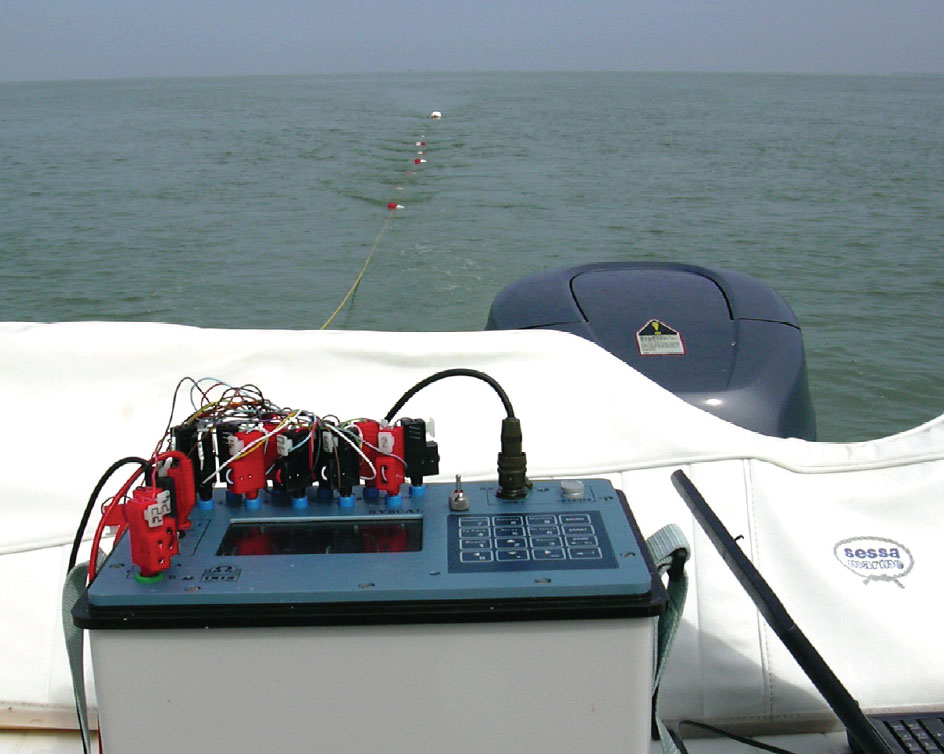
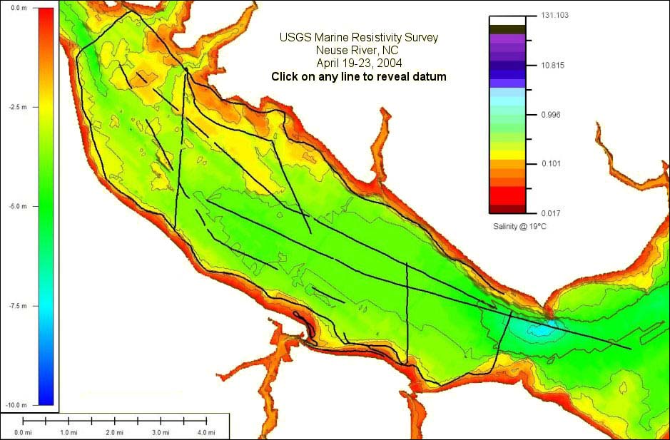
Marine Survey Techniques - Marine Electrical Resistivity
The water body's bottom is covered with a marine multi-electrode cable that was specially made for the purpose. There are 25 electrodes in the cable. To calculate electrical resistivity as a function of depth along the electrode array, a control unit applies current, measures the potential from various pairs of electrodes, and applies the appropriate voltage. A programme for two-dimensional inversion is used to process the data. The programme uses a nonlinear least-squares optimization method to find the best fit for the data automatically. Applications include detecting sediment types (clay vs. sand), pinpointing groundwater discharge zones beneath the ocean, mapping geologic structures, and figuring out the geologic conditions below the mudline.
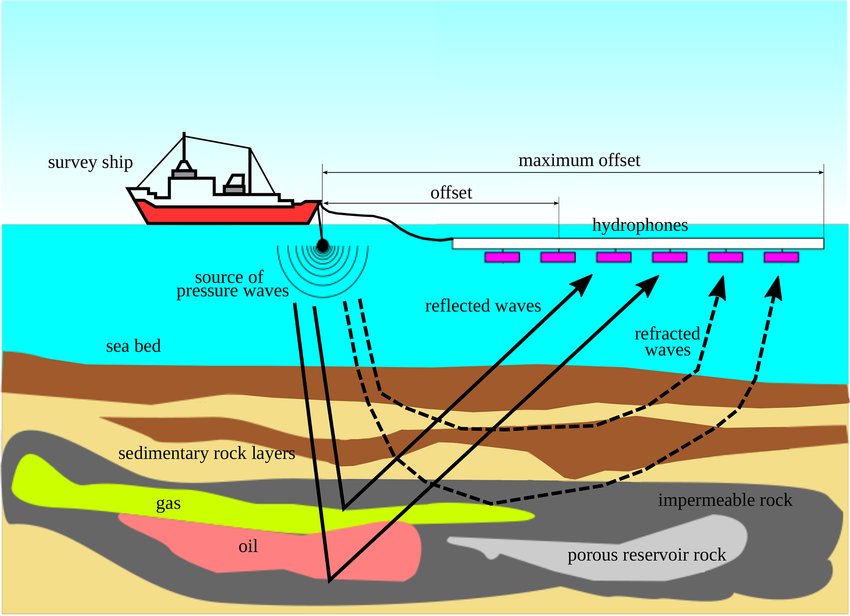
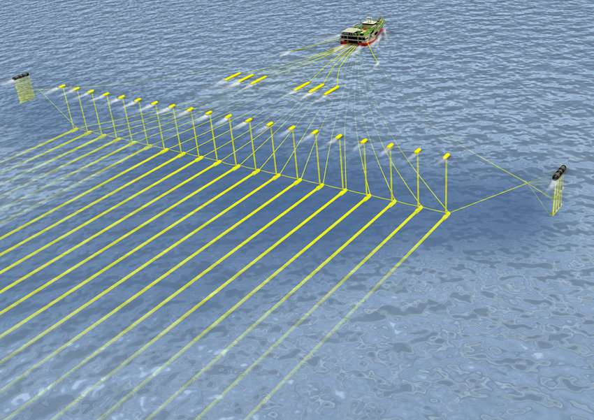
Marine Survey Techniques - Marine Seismic Method
Based on the propagation of seismic waves, marine seismic techniques are geophysical tools for studying the sub-bottom geology. For geotechnical and geological engineering projects where the depth to reliable bedrock and knowledge of fracture or shear zones is crucial, marine seismic refraction data are often gathered. A seismic wave is induced into the seafloor using the seismic reflection technique, and the waves that are reflected from the subsurface strata are then recorded. Geology can be mapped using seismic reflection at depths greater than (50 m).
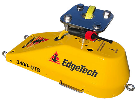
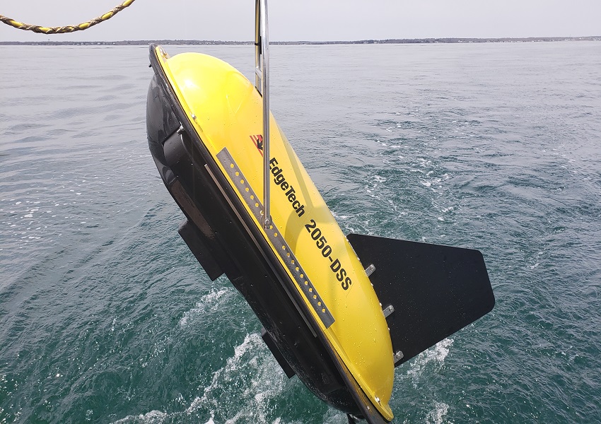
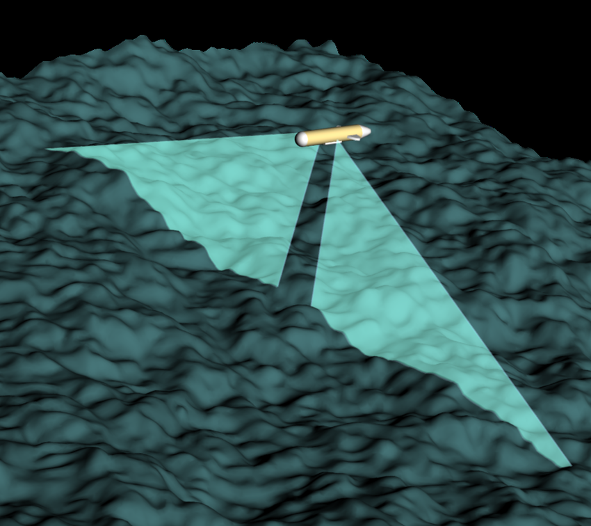
Marine Survey Techniques - Side Scan Sonar Surveys
Side scan: A picture or image of the ocean floor is produced by sonar. It creates a picture by measuring the strength of how "loud" the return echo is. In comparison to softer parts like sand, the sea floor's hard surfaces, like rocks, reflect more sound and provide a stronger or louder return signal. Darker than quieter locations are those with loud echoes. Shadows are also produced in the sonar image where no sound was detected by objects or features that rise above the ocean floor. One can estimate the size of the feature by the size of the shadow.
Marine Survey Techniques - Sub-Bottom Profiling
In this context, the term "sub-bottom profiling" (SBP) refers to the high-resolution depiction of rock and sediments beneath bodies of water. We can identify and map the interfaces between different sedimentary layers or the overburden/bedrock contact beneath a body of water using marine geological profiling. The method is based on seismic reflection theory, which involves sending a seismic wave into the ground and receiving the energy it reflects off various interfaces.