Geophysical Techniques: Electromagnetic Methods
The electrical conductivity of the ground is measured in electromagnetic (EM) surveying as a function of depth and horizontal distance. The electrical conductivity of different rocks varies in value. The electromagnetic approach relies on the magnetic component of electromagnetic waves that are produced at the surface to induce electric currents in the ground.
A wire coil (a transmitter coil) is subjected to an alternating current with changeable frequency. Through this method, an alternating primary magnetic field is created, which causes very small eddy currents to form in the earth. The size of these currents is directly correlated with the ground conductivity around the coil. The secondary magnetic field produced by these eddy currents is subsequently partially absorbed by a receiving coil. The voltage produced by the receiver coil's interaction with the primary and secondary magnetic flux is correlated with the subsurface electrical conductivity.
Applications & Use Cases
We specialize in this Geophysical Techniques that are offering valuable insights & data.
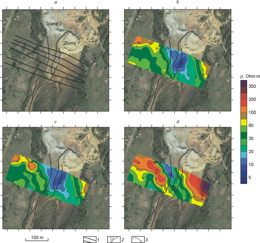
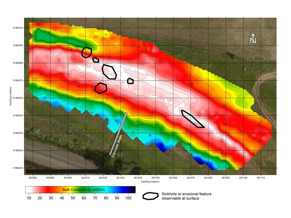
- Geological and hydrogeological studies
- Bedrock and stratigraphy mapping
- Ground water and mineral exploration
- Utility detection and mapping
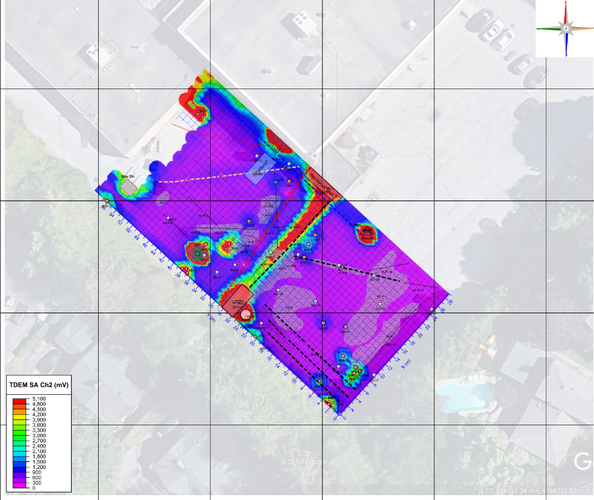
Electromagnetic Techniques - Time Domain Electromagnetic (TDEM)
In TDEM, transient pulses of electric current are used to create electric and magnetic fields, and the response's subsequent decay is measured. The primary electrical field is sent using coils on the ground, while the secondary magnetic field is received using coils on the ground. The size of the transmitting coil on the ground, the strength of the current, and the conductivity of the layers all affect how deep the probe goes.
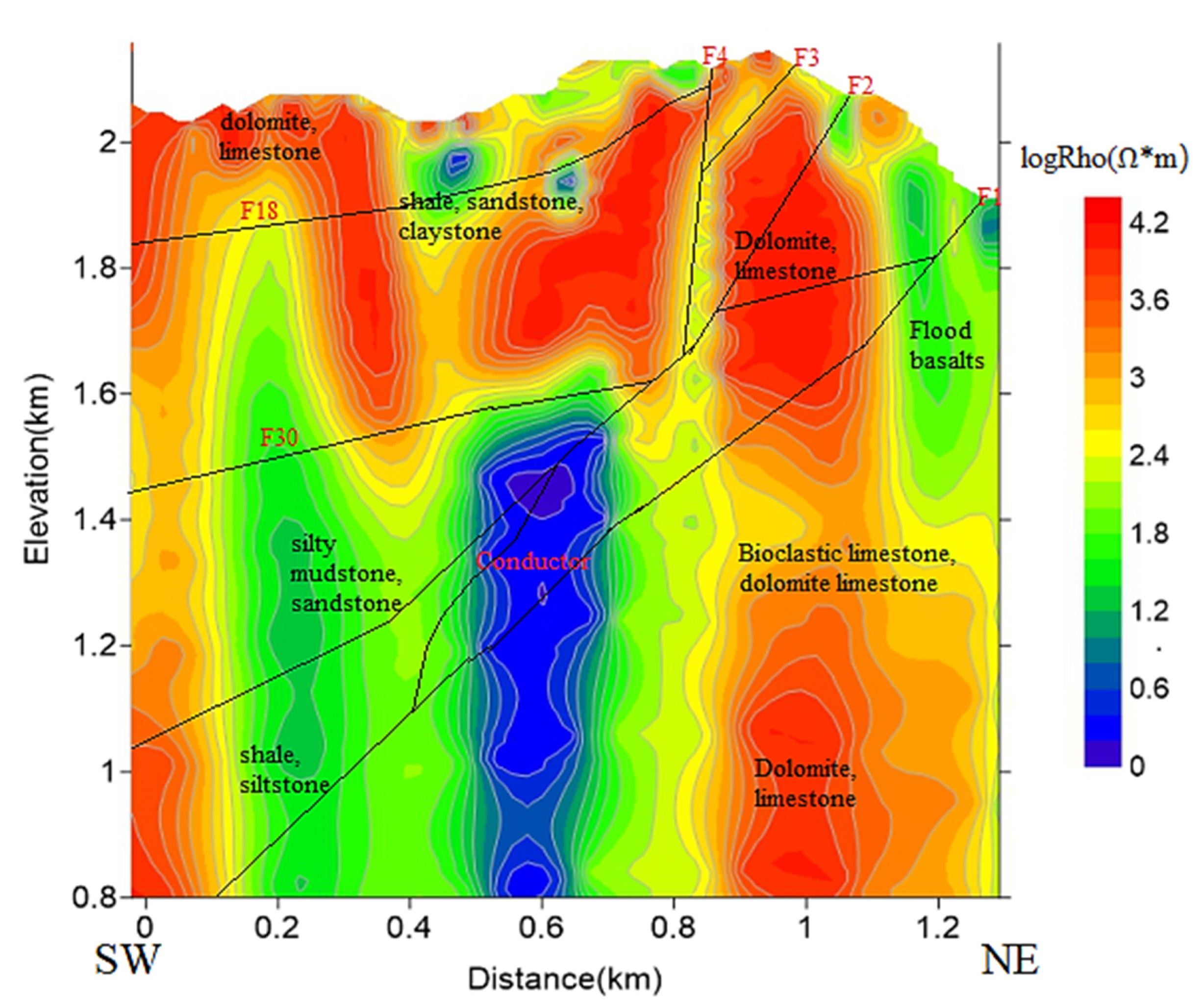
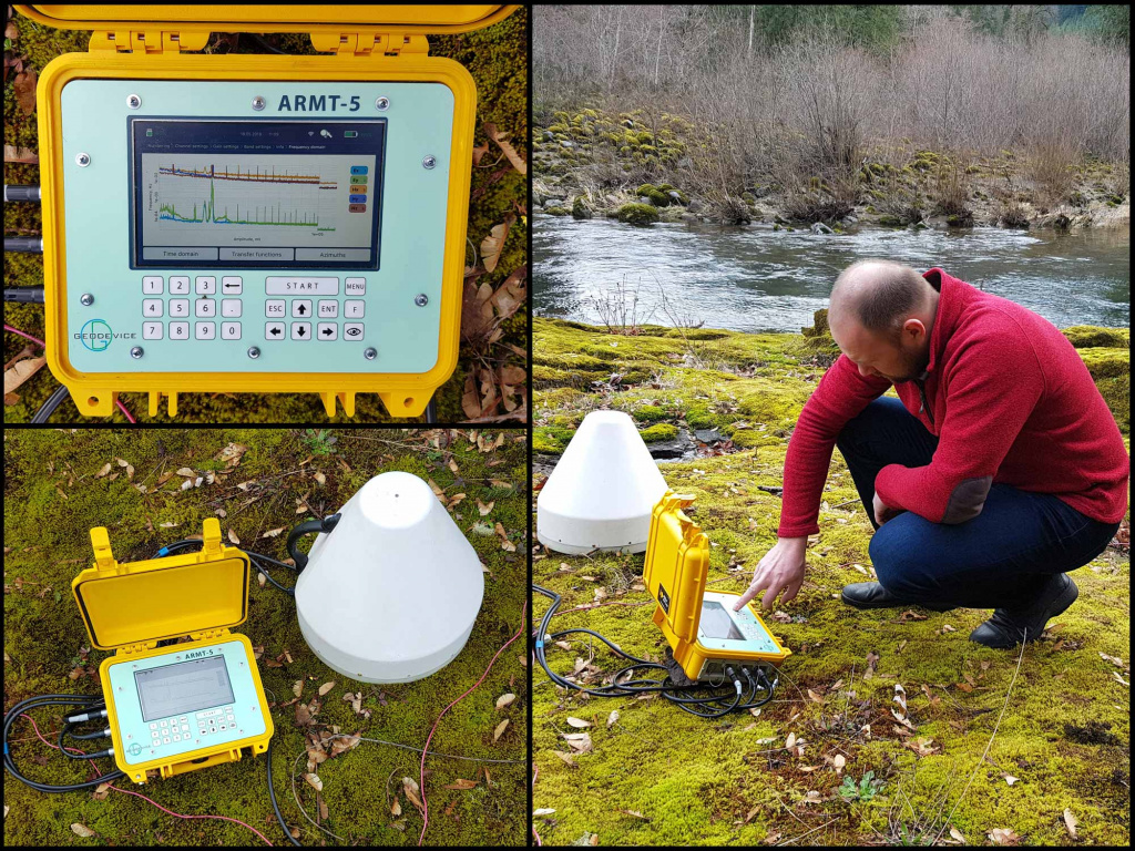
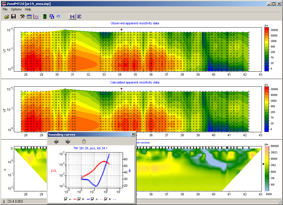
Electromagnetic Techniques - Magnetotellurics (MT AND AMT)
Using passive energy sources such as lightning storms and naturally occurring ionospheric current sheets, the electro-magnetic survey and imaging techniques known as magnetotellurics (MT) and audio-frequency MT (AMT) may map geologic features to depths of 500 metres or more. The MT geophysical survey method incorporates measurements of the earth's magnetic and electric fields across a broad frequency range.
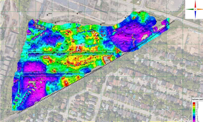
Electromagnetic Techniques - Frequency Domain Electromagnetic (FDEM)
Frequency Domain Electro Magnetic (FDEM) induction involves producing electromagnetic fields that cause currents to flow through the ground, which then trigger secondary magnetic fields to form beneath the surface. Subsurface characteristics and features can be determined by detecting the magnetic fields. The electrical conductivity of the subsurface is connected to the size and phase of the induced currents, which are measured using this technique.
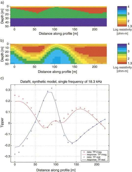
Electromagnetic Techniques - Very Low-Frequency Electromagnetic (VLF)
Low-frequency transmissions are used as the source in the continuous-wave (frequency domain) electromagnetic technique known as very-low-frequency (VLF) surveys. Measurements of this field's orientation are done during VLF surveys. The technique has been effectively utilized in engineering and groundwater surveys to find conductive fault zones and other sub-vertical conductors, while it is mostly used in mineral exploration operations.