Aerial Survey Services: LiDAR Survey
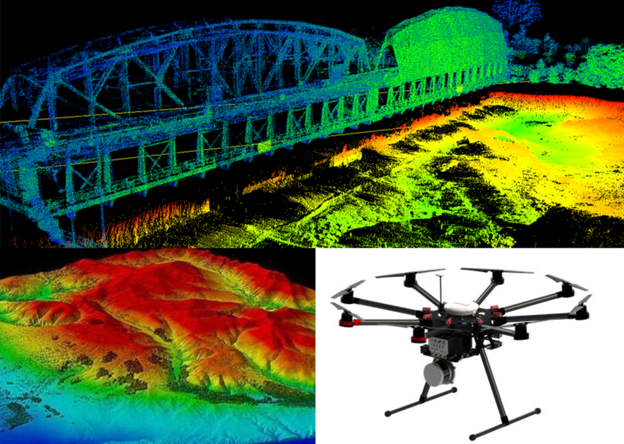
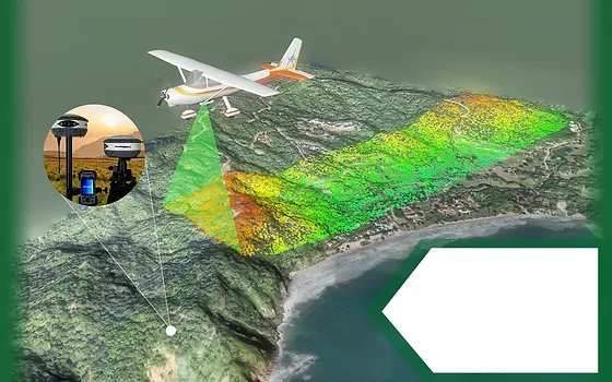
To estimate the height of points in the environment beneath a UAV, UAV LiDAR includes placing a laser scanner on the UAV. Actually, LiDAR stands for light detection and ranging. In a single day, LiDAR scanners may collect data covering hundreds of square km. A extremely accurate digital landscape model can be produced by measuring 10-80 points per square metre. Because of the measures' accuracy, the resulting 3D models can be used in many different planning, design, and decision-making processes.
LiDAR operates on the principle of sending laser pulses towards the ground and measuring the time it takes for the reflected light to return. By calculating the distance, LiDAR systems can generate precise elevation data. LiDAR scanners are mounted on UAVs to capture data over a designated area. This allows for the collection of elevation information over diverse terrains, including forests, urban areas, and agricultural fields. In a single day, LiDAR-equipped UAVs can cover large areas, sometimes hundreds of square kilometers, capturing detailed information with remarkable efficiency.
Applications & Use Cases
We specialize in this Aerial Survey Services that are offering valuable insights & data.
- Natural Resource Planning & Management
- Disaster Response and Management
- Forestry & Fire Risk Management
- Urban Development & 3D City Modeling
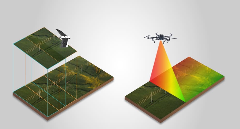
LiDAR-equipped UAVs can rapidly collect data over large areas, making them more efficient compared to traditional survey methods. The high density of LiDAR points ensures a detailed and accurate representation of the terrain, which is crucial for applications requiring precision. In summary, the integration of LiDAR technology with UAVs has revolutionized the way we collect and utilize geospatial data. The highly accurate and detailed information provided by LiDAR is instrumental in various fields, with applications ranging from environmental monitoring to infrastructure development.